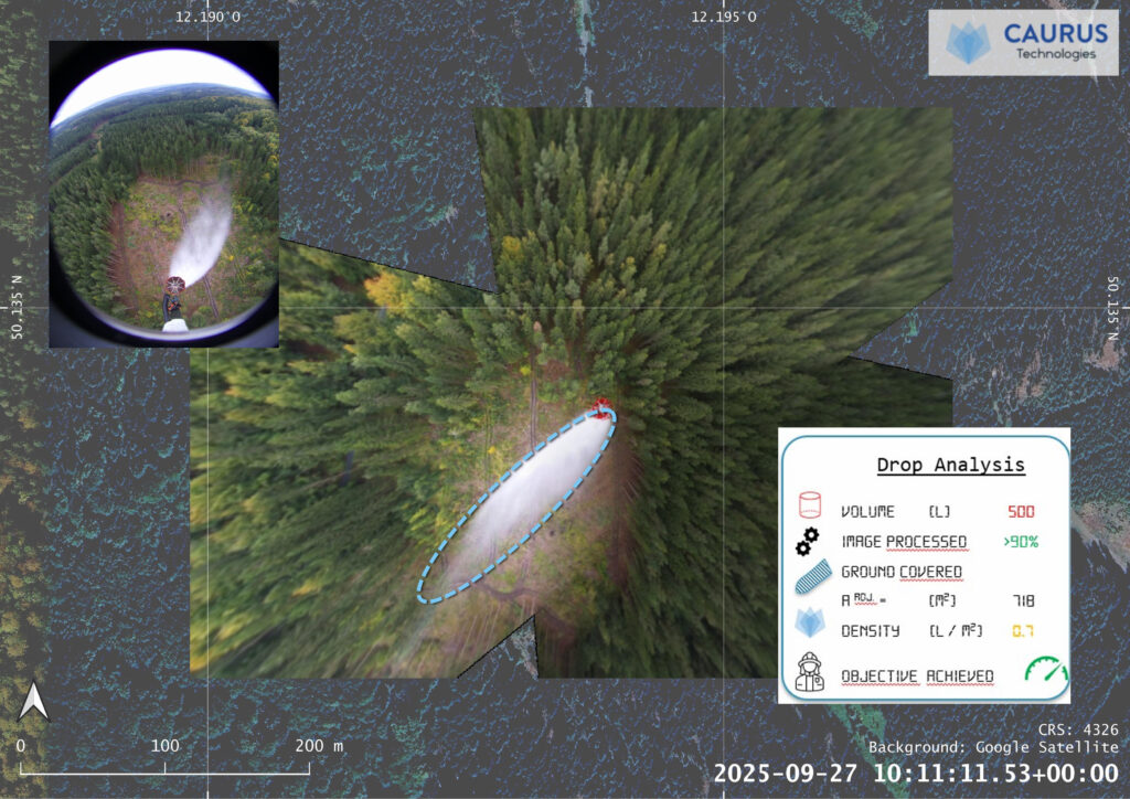
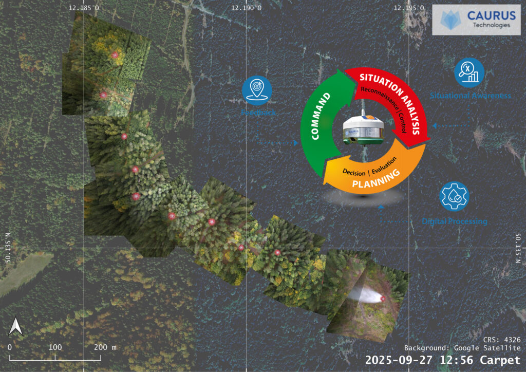
CAURUS Technologies has successfully passed the application process for their project “Forest Shield” under the auspices of the Forest Fire Fighting Transfer Laboratory (FFFLab). The funding for project “Forest Shield” will now be used to further develop an innovative system that aims to significantly improve the efficiency of water drops in aerial firefighting and digital situational awareness. The goal is to precisely analyze the effectiveness of drops by linking georeferenced sensor data from the visible and infrared spectrums with new simulation models, thereby enabling, among other things, feedback on the success of firefighting measures. This provides firefighters and their incident commands with a broader basis for decision-making, allowing them to deploy extinguishing agents more precisely and increase the effectiveness and safety of aerial firefighting.
The project is being carried out in collaboration with the Fraunhofer Institute for Industrial Mathematics (Fraunhofer ITWM) and combines simulation and inference models. Based on Fraunhofer ITWM’s MESHFREE simulation software, a demonstrator will be developed for the analysis and simulation of aerial water drops. To this end, the images and data collected and processed by the CAURUS Technologies sensor and its software during water drops on firefighting missions are being used.
In the long term, the simulation system is intended to make aerial water drops more predictable, i.e. significantly improving the predictability of the water drops’ effectiveness — the inference — as well as the precision, efficiency, and safety for the firefighting personnel involved. Additionally, forestry expertise will be incorporated and utilized more extensively. Together, simulation and inference form a continuous learning system.
Dr. Jeroen Staab joins the team
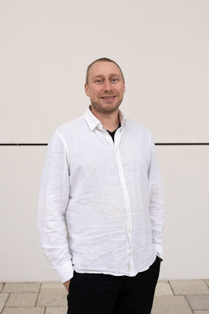
For the project, the startup company has also expanded its team and welcomes Dr. rer. nat. Jeroen Staab to CAURUS Technologies. Dr. Staab has been developing AI-supported workflows at the intersection of geospatial AI, computer vision, and classical data analysis since 2016. Previously, he worked over six years at the German Aerospace Center (DLR) as a researcher in the Geohazards and Civil Security Department. His core expertise includes the development of automated systems for extracting relevant information from a wide variety of data sources. He scales this technology—also known as “computer vision”—from satellite-based Earth observation to practical applications using drones and other optical surveillance systems. He also brings extensive experience in managing scientific projects and analyzing complex spatial challenges.